

Quick answer
The Icefields Parkway is 232 kilometres (144 miles) long, stretching along Highway 93N between Lake Louise and Jasper. The drive takes approximately three hours non-stop, but most travellers allow five to eight hours to visit roadside attractions including the Columbia Icefield, Peyto Lake, Athabasca Falls, and numerous glacier viewpoints. During summer months, wildlife sightings and photo stops frequently extend travel time to a full day.
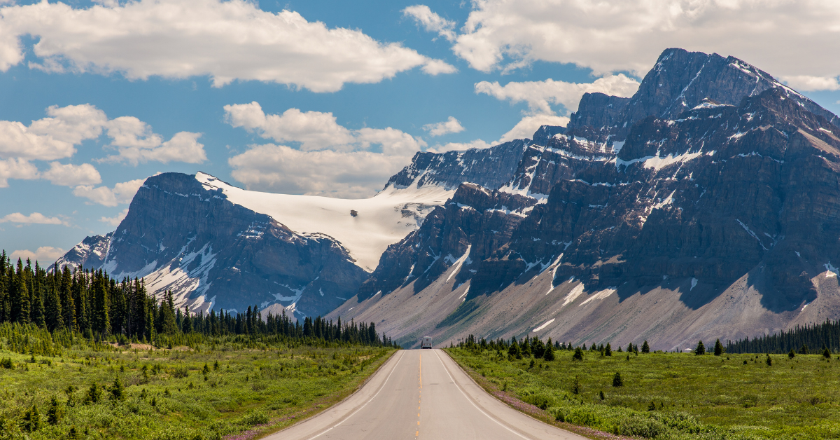
The Icefields Parkway covers 232 kilometres of two-lane mountain highway, climbing through avalanche zones, river valleys, and alpine meadows between Lake Louise and Jasper. It is widely considered one of the most scenic drives in the world, yet the question of how long the Icefields Parkway takes to drive depends less on distance than on how many times you pull over. At highway speed—80 kilometres per hour on most stretches, reduced to 60 through wildlife corridors—the route requires three hours of uninterrupted driving. Few visitors manage that. The parkway passes more than 100 visible glaciers, dozens of waterfalls, and roadside viewpoints designed for lingering. The Columbia Icefield Skywalk, Athabasca Glacier, Mistaya Canyon, and Peyto Lake each warrant at least thirty minutes. Add short hikes, wildlife pauses for mountain goats or grizzly bears, and fuel or meal stops in Saskatchewan River Crossing, and the journey stretches to six or eight hours—sometimes more. The Icefields Parkway route begins at the junction with the Trans-Canada Highway near Lake Louise and climbs steadily through Banff National Park before crossing into Jasper National Park at Sunwapta Pass, the highest point at 2,035 metres. Cellular service is sparse, fuel is available only mid-route, and weather shifts rapidly at elevation. Parks Canada requires a daily national park admission pass, priced at 12.25 CAD per adult, valid across both Banff and Jasper. The road remains open year-round, though winter driving demands snow tires, and several viewpoints close seasonally. Arriving early—ideally between 07:00 and 10:00—secures parking at popular stops and avoids tour-bus crowds that peak mid-afternoon. Many visitors split the journey over two days, overnighting in Jasper or at backcountry lodges along the corridor. The parkway's length is fixed, but how long you spend on it is a choice shaped by how much alpine wilderness you're willing to leave behind.
“The parkway passes more than 100 visible glaciers, dozens of waterfalls, and roadside viewpoints designed for lingering.”
How Long Is the Icefields Parkway: Planning Your Drive
This itinerary suits travelers who want to experience the Icefields Parkway's highlights without rushing. Budget a full day to cover the 232-kilometer route with stops at major viewpoints and short trails.
Depart from Jasper or Lake Louise
Leave early to maximize daylight and avoid midday traffic at popular stops. The drive itself takes 3-4 hours without interruptions.
First lookouts and glacier views
Pull over at Sunwapta Falls, Athabasca Glacier viewpoint, or Peyto Lake overlook depending on your direction. Each stop adds 15-30 minutes.
Mid-route trails and lunch
Tackle a short hike like Parker Ridge (2.4 km return) or Mistaya Canyon (800 m loop), then stop for a packed lunch at a picnic area. Allow 1-2 hours for a trail plus rest time.
Southern highlights or northern sections
Continue to Bow Lake, Saskatchewan Crossing, or the Columbia Icefield area depending on your route. Factor in photo stops and washroom breaks.
Final stretch and arrival
Complete the remaining drive to your endpoint, arriving with daylight to spare. The highway is open 24 hours, but services and facilities close at dusk.
Best Time to Drive to Understand How Long Is the Icefields Parkway
The best time to experience the Icefields Parkway is during the shoulder months of June and September, arriving within the optimal arrival window of 07:00–10:00. Starting early allows travelers to avoid mid-day congestion and maximize daylight hours for the drive.
Summer (July–August)
High traffic volumesWarm, 15°C to 25°C
Roads are fully accessible but parking at major pull-offs fills quickly during peak hours.
Shoulder Season (June, September)
Moderate trafficMild, 5°C to 20°C
This period offers a balance of accessible roads and manageable crowd levels.
Weekday Mornings
Minimal congestion—
The best time to drive is between 07:00–10:00 to avoid mid-day crowds and ensure a consistent pace.
Verdict: For the most efficient drive, visit during the shoulder months of June or September and enter the parkway between 07:00–10:00 on a weekday.
Getting to and Navigating the Route for How Long Is the Icefields Parkway
The Icefields Parkway, located at Highway 93N, Banff and Jasper National Parks, Alberta, Canada, connects Lake Louise in the south to Jasper in the north. Access requires a personal or rental vehicle, as public transit options are not available for this route.
Highway 93N from Lake Louise
Highway 93N from Jasper
Key Stops to Include When Deciding How Long Is the Icefields Parkway
The Icefields Parkway, or Highway 93N, features numerous geological landmarks that influence how much time is required for the journey. Planning stops at these specific locations helps visitors pace their drive through Banff and Jasper National Parks.
Bow Lake
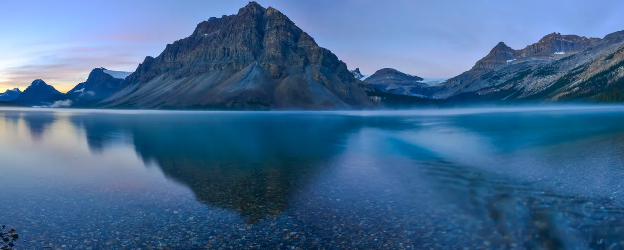
A glacial lake located near the headwaters of the Bow River with clear reflections of the surrounding peaks.
Visit early in the morning for calm water and mirror reflections.
Peyto Lake
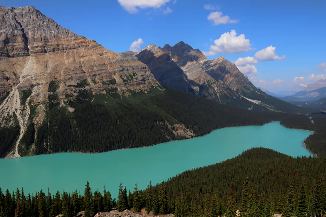
Known for its distinct turquoise color caused by glacial rock flour, reached by a short hike from the parking area.
Walk past the main viewpoint to the higher ridge for fewer crowds.
Columbia Icefield
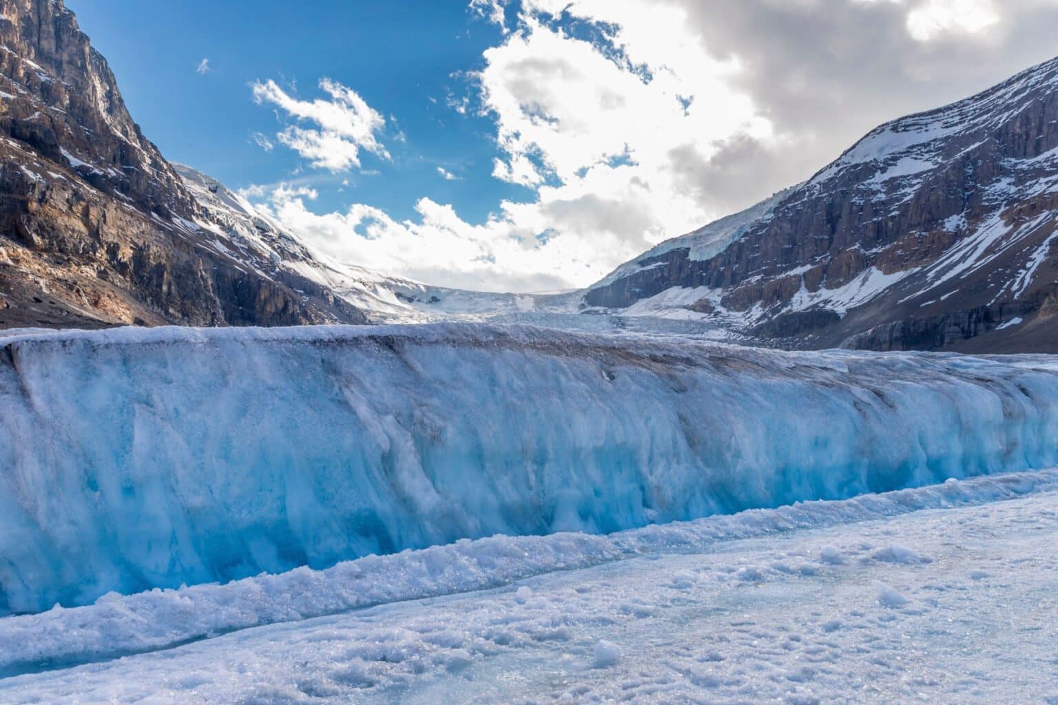
The largest icefield in the Canadian Rockies, serving as a primary point for glacier exploration.
Access the toe of the Athabasca Glacier via designated trails.
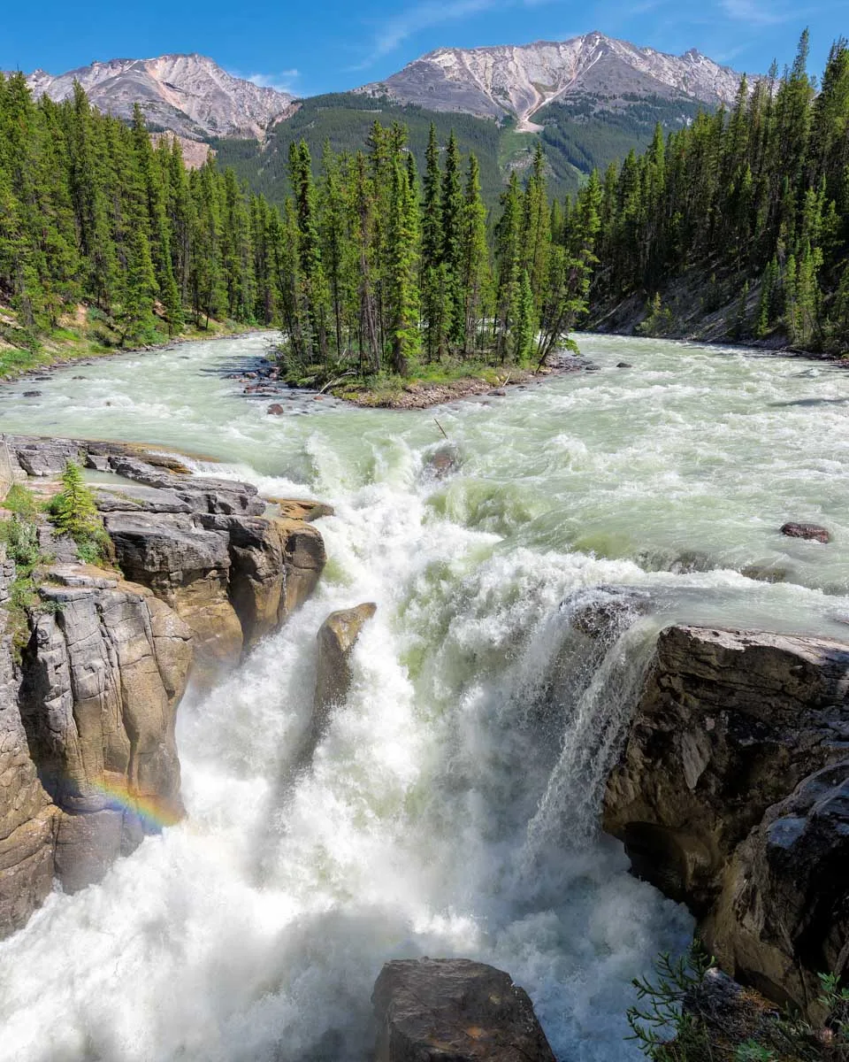
Sunwapta Falls
A waterfall fed by the Athabasca Glacier featuring a central island and a dramatic canyon drop.
Walk across the bridge to the upper falls for the full drop view.
Essential Preparation for How Long Is the Icefields Parkway
The Icefields Parkway requires specific preparation due to its remote location and 232-kilometer length through wilderness terrain.
-
Purchase a Parks Canada Discovery Pass — Required for entry into Banff and Jasper National Parks along the entire route.
-
Fill your fuel tank completely — No gas stations exist between Lake Louise and Saskatchewan River Crossing, a 77-kilometer stretch.
-
Pack emergency supplies and blankets — Cell service is limited and weather conditions can change rapidly at high elevations.
-
Download offline maps before departure — GPS and mobile data are unreliable throughout most of the parkway.
-
Check road conditions on Alberta 511 — Highway 93N closes seasonally and weather can cause unexpected closures year-round.
-
Bring water and snacks for stops — Services are sparse with only a few facilities between Jasper and Lake Louise.
-
Ensure your spare tire is functional — Roadside assistance is limited and help may be hours away in remote sections.
Check availability
Frequently asked questions about how long is the icefields parkway
Everything you need to know about how long is the icefields parkway